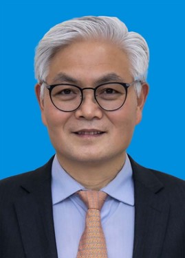
CHEN Baozhang
Professor · Doctoral Supervisor
Founding Editor-in-Chief, Spatio-Temporal Intelligence (MDPI)
State Key Laboratory of Resources and Environmental Information System (LREIS), Institute of Geographic Sciences and Natural Resources Research, Chinese Academy of Sciences
Address: 11A Datun Road, Chaoyang District, Beijing 100101, China
Email: baozhang.chen@igsnrr.ac.cn Tel: +86-10-64889574
1. Profile
CHEN Baozhang is a Professor and doctoral supervisor at the Institute of Geographic Sciences and Natural Resources Research (IGSNRR), Chinese Academy of Sciences (CAS), and Chief Scientist for Surface Earth System Modeling at the University of Chinese Academy of Sciences. He holds two PhDs, one from the University of British Columbia (UBC), Canada, and one from the China University of Mining and Technology. He is the Founding Editor-in-Chief of the international journal Spatio-Temporal Intelligence (MDPI). After obtaining full-professor qualification in Jiangsu Province in 2000, he served as a Professor at Xuzhou Normal University (now Jiangsu Normal University). He then worked in Canada at the University of Toronto and UBC, and as a Professor at Kwantlen Polytechnic University, before returning to China in 2009 through a CAS talent recruitment program.
His research focuses on spatio-temporal intelligence, GeoAI and Earth observation, spatio-temporal data mining and causal inference, and digital twins of the Earth system, together with data–model assimilation, carbon monitoring and carbon assimilation systems, surface Earth system modeling and responses to global change. He developed the Dynamic Land Model (DLM), China’s first space–air–ground integrated “dual-carbon” digital twin simulator, China’s high spatio-temporal resolution carbon assimilation systems (CarbonTracker-China and 3-GAS), and the high-resolution nested Regional Carbon Assimilation System (RCAS). These systems are in quasi-operational use at the national level and provide high-accuracy, multi-scale accounting of carbon emissions and sinks for provinces and cities; his contributions to global, national and local carbon accounting and carbon-neutrality assessment are recognized by international peers and government agencies. In environmental archaeology and palaeoecology, he discovered in the 1990s the ~8,000-year-old cultivated rice remains at the Jiahu site, Wuyang, Henan Province — at the time the earliest known domesticated rice in the world and still the northernmost known centre of early rice domestication — a finding of landmark significance for the history of human civilization.
He has led or served as a key investigator on more than 10 national research projects in Canada (NSERC, CFCAS, etc.) and has led more than 20 research projects in China, including a Key Project of the NSFC Original Exploration Program, NSFC Key and General Projects, the National Key R&D Program, the 973 and 863 Programs, the National Key Technology R&D Program, and the CAS Strategic Priority Research Program. He has published more than 200 papers (over 120 indexed in SCI) in journals such as Nature Communications, Science Bulletin, Global Change Biology, Remote Sensing of Environment, New Phytologist, Chinese Science Bulletin and Acta Geographica Sinica; authored one monograph, led the writing of another and contributed to three edited books; and holds 7 granted Chinese invention patents and more than 20 software copyrights.
His honours include a Second Prize of the Natural Resources Science and Technology Award (Scientific and Technological Progress; 2023, ranked 1st), two Second Prizes of the Environmental Technology Progress Award (2024 and 2025, both ranked 1st) and a Second Prize of the Environmental Protection Science and Technology Award (2019, ranked 6th). Earlier he received the 3rd China Young Geographer Science and Technology Award of the Geographical Society of China (1995), and was selected as an Outstanding Young Key Teacher of Jiangsu Universities (1996), a Young and Middle-aged Leading Scientist of the Jiangsu “333 High-Level Talent Training Project” (1998) and an Innovative Talent and Innovative Team member of the Jiangsu “Double Innovation Plan” (2014). He has received more than 20 personal academic awards, including the IET Excellent Graduate Scholarship and the NSERC Alexander Graham Bell Canada Graduate Scholarship (CGS), Canada’s most prestigious graduate scholarship.
2. Education
2012.04 PhD, Agricultural and Forest Meteorology, University of British Columbia (UBC), Faculty of Forestry, Canada
1999.06 PhD, Mineral Prospecting and Exploration, China University of Mining and Technology, China
1988.08 MSc, Marine Geology, Tongji University, China
1985.07 BSc, Mineral Prospecting and Exploration, Changchun College of Geology (now Jilin University), China
3. Professional Experience
2009.06–present Professor and doctoral supervisor, Institute of Geographic Sciences and Natural Resources Research, CAS (State Key Laboratory of Resources and Environmental Information System, LREIS)
2007.09–2009.06 Professor, Kwantlen Polytechnic University, Canada
2006.09–2007.08 Research Associate, University of British Columbia, Canada
2001.04–2006.09 Postdoctoral Fellow and Research Associate, University of Toronto, Canada
2000.10–2001.04 Visiting Scholar, Pacific Geoscience Centre, Natural Resources Canada
1990.10–2001.10 Lecturer, Associate Professor and Professor, Xuzhou Normal University (now Jiangsu Normal University), China (qualified as full Professor in August 2000 by the Jiangsu Senior Professional Title Evaluation Committee for University Teachers, approved by the Jiangsu Provincial Department of Personnel)
1988.08–1990.10 Research Assistant and Assistant Research Fellow, Institute of Marine Geology, Ministry of Geology and Mineral Resources, China
4. Academic Appointments
Current
• Founding Editor-in-Chief, Spatio-Temporal Intelligence (MDPI; ISSN 3043-1883)
• Executive Vice President, International Association of Natural Resources (iAONR); Chair, iAONR Committee on Remote Sensing and Spatio-Temporal Intelligence
• Chief Scientist for Surface Earth System Modeling, University of Chinese Academy of Sciences
• Member, Technical Committee for the Carbon Monitoring and Assessment Pilot Program, Ministry of Ecology and Environment of China
• Editorial board member of more than 10 journals, including Geographical Research, Scientific Data (Nature Portfolio), Forests, Water and Atmosphere; Guest Editor of several Special Issues
Previous
• Chief Scientist, Greenhouse Gas and Carbon Neutrality Monitoring and Assessment Center, China Meteorological Administration
• Expert, First Review Committee after the reform of the CAS Academician election procedures
• Reviewer, “Changjiang Scholars Program”, Ministry of Education of China
• Reviewer, NSFC Young Scientists Fund (Categories A and B)
5. Research Interests
• Spatio-temporal intelligence: theories and methods enabling dynamic worlds to be perceived, represented, understood, reasoned about, predicted, simulated and responded to
• GeoAI and Earth observation: integration of remote sensing and geospatial AI; foundation models and intelligent interpretation
• Spatio-temporal data mining and causal inference: fusion of multi-source, multi-scale spatio-temporal data; scaling; spatio-temporal causal analysis
• Digital twins of the Earth system: space–air–ground dual-carbon digital twin simulator; closed-loop sensing–cognition–action systems
• Data–model assimilation and carbon assimilation systems: CT-China, RCAS, 3-GAS and other multi-scale carbon inversion systems; joint satellite–ground assimilation
• Carbon monitoring and carbon-neutrality assessment: integrated space–air–ground carbon monitoring networks; high-accuracy accounting of carbon emissions and sinks
• Land surface modeling and land–atmosphere interactions: the Dynamic Land Model (DLM); coupled carbon–nitrogen–water processes; ecohydrology
• Environmental remote sensing, GIS and environmental big data: multi-source remote sensing fusion; flux footprint models; spatial analysis
• Biodiversity, ecosystem functions and services: habitat quality, ecosystem service assessment and ecological security
• Global change and environmental archaeology: responses of terrestrial ecosystems to climate change; phytolith analysis and the origin of rice cultivation
6. Major Research Achievements
(1) Surface Earth system modeling, data–model assimilation and carbon assimilation systems
Focusing on remote sensing, ecological modeling, the carbon cycle and climate change, and guided by integrated soil–vegetation–atmosphere theory, he has carried out systematic research on remote-sensing-based land surface and carbon cycle model development, model coupling, multi-source and multi-scale data assimilation, data–model fusion and scaling, achieving a series of original results: (1) a “bottom-up” regional carbon source/sink modeling system based on multi-source, multi-scale data fusion, comprising process-based ecohydrological models, remote sensing retrieval models and remote-sensing-driven carbon process models; (2) a “top-down” atmospheric CO₂ inversion and data–model assimilation system for China, CarbonTracker-China; and (3) joint satellite–ground CO₂ assimilation, an efficient hybrid ensemble Kalman filter–4D-Var algorithm, and the coupling of process models, remote sensing retrieval models and atmospheric CO₂ assimilation models, culminating in China’s first space–air–ground data-fusion dual-carbon digital twin simulator, now in quasi-operational national use and supporting high-accuracy multi-scale carbon accounting for provinces and cities. These original and leading results have been highly evaluated by peers in China and abroad, serve national needs for assessing the effectiveness of carbon peaking and carbon neutrality actions, and continue to support global climate change research. The main achievements are summarized in five areas:
1. China’s first high-resolution CO₂ assimilation and inversion system — CarbonTracker-China
Following NOAA’s CarbonTracker (USA) and CarbonTracker-Europe, this is the third complete global-scale nested carbon assimilation system in the world, pioneering the joint assimilation of satellite and ground-based observations for atmospheric CO₂ source/sink estimation.
2. The high-resolution, high-efficiency Regional Carbon Assimilation System (RCAS)
Key innovations: (1) an efficient hybrid ensemble Kalman filter–4D-Var algorithm that overcomes the computational bottleneck of conventional ensemble or variational methods for very-high-dimensional regional systems, enabling efficient kilometre-scale CO₂ flux inversion; (2) the POD-4DVar method for simultaneous assimilation of regional CO₂ emissions and concentrations; (3) real-time optimization of key carbon process parameters with ecosystem flux observations, enabling simultaneous assimilation of natural and anthropogenic fluxes; (4) a joint multi-satellite–ground regional assimilation system combining satellite column CO₂, ground-based CO₂ observations and atmospheric transport models, overcoming the scarcity of high-precision ground observations and improving inversion accuracy; and (5) nesting RCAS with CT-China and integrating AI to build China’s first space–air–ground dual-carbon digital twin simulator, which assimilates natural carbon fluxes and anthropogenic emissions at 1–5 km resolution, runs quasi-operationally at the national level, and supports high-accuracy provincial and city-level carbon accounting.
3. The integrated Dynamic Land Model (DLM) with independent intellectual property rights
DLM introduces a canopy clumping index and divides the canopy into four leaf classes — sunlit and shaded leaves of the overstory and understory — computing radiation balance, resistances, photosynthesis and sensible and latent heat fluxes for each class. Coupled with data–model assimilation, it moves from quantitative process simulation to system integration and plays an important role in analyzing and simulating key land surface processes.
4. Greenhouse gas flux and concentration footprint model (SEAF: Simple Analytical Footprint model on Eulerian coordinates)
SEAF, based on Eulerian field theory, has been widely used for analyzing spatial heterogeneity, scaling and interpreting global flux network (FLUXNET) observations, and was adopted by the Canadian Carbon Program (CCP) as the routine evaluation method for all Fluxnet-Canada sites. He coupled the remote-sensing-driven, fixed-grid EASS land surface model with GEM, the very large variable-grid regional climate model used for Canada’s national weather forecasting (mixed C++/Fortran), solving the challenges of coupling, debugging and parallel computing for very large models. Using the on-line coupled model, he studied scale effects in carbon, water and energy exchange and proposed new theories and methods for scaling carbon sources and sinks at national and continental scales.
Based on Landsat TM/ETM+ imagery and flux tower data, he developed an upscaling method combining tower footprint analysis and multi-source data fusion, extending ecosystem-scale (1–3 km) tower observations to landscape and regional scales. The method combines footprint models, machine learning (e.g., modified regression trees) and image fusion, and offers high efficiency, accuracy and robustness compared with other upscaling approaches. Results from eddy covariance, Landsat and MODIS retrievals and CarbonTracker inversions were independently compared and validated at regional and landscape scales, and published in Remote Sensing of Environment, Agricultural and Forest Meteorology and Remote Sensing.
5. China’s first automated multi-angular spectral monitoring system (AMSPEC II: Automated, Multi-angular SPECtroradiometer system)
Protected by the invention patent “A multi-angle continuous ground-object spectral observation system with automatic calibration”. The system includes a retractable reference panel module for automatic white-reference calibration (also under poor illumination and weather), an air-purge module for cleaning the reference panel, and a rotating pan-tilt unit for high-precision angular control. It enables continuous, automated multi-angle spectral observation and data acquisition at a 30-min frequency matched to eddy covariance flux systems, providing an important tool for agricultural and forest remote sensing, ecological process studies and scaling.
The system was deployed in the Heihe Watershed Allied Telemetry Experimental Research (HiWATER), acquiring hyperspectral observations continuously and tracking the viewing geometry of satellites such as MODIS and Landsat for coordinated satellite–ground observation. It was the first application worldwide of a modified multi-angular automated spectrometer to crops (Zhangye maize super-station). Building on this, he designed an ASD full-spectrum in-situ automated observation system with 360° rotation sampling a 61-m-diameter footprint — the world’s first in-situ automated full-spectrum monitoring system.
(2) Linking these achievements to spatio-temporal intelligence
These achievements are themselves exemplary practices of spatio-temporal intelligence (STI) and are closely aligned with the scope of the international journal Spatio-Temporal Intelligence that he founded:
• China’s first space–air–ground dual-carbon digital twin simulator: a digital twin of the Earth system and a closed-loop sensing–cognition–action system, linking multi-source observation to accounting, assessment and decision support.
• CT-China and RCAS spatio-temporal data assimilation systems (EnKF-4DVar, POD-4DVar): multi-source, multi-scale spatio-temporal data fusion and reasoning.
• SEAF footprint model and flux-tower spatial representativeness: fundamentally questions of spatio-temporal measurability and scaling — core scientific problems of STI.
• Coupling RCAS with artificial intelligence: hybrid modeling of GeoAI and physical process models, combining data-driven learning with mechanistic constraints.
(3) Environmental archaeology and palaeoecology
In the 1990s, using phytolith analysis, Chen discovered rice remains about 8,000 years old at the Jiahu site in Wuyang County, Henan Province. Located in the Central Plain of the Yellow River basin and dated to 8942–7801 BP, the site yielded what was then the earliest known cultivated rice in the world. Lying north of 33°37′ N, far beyond the present range of wild rice, the finding overturned the then-prevailing view in archaeology that rice cultivation originated in the Yangtze River basin. Using pollen and phytoliths as climate proxies, he further showed that 8,000 years ago the Central Plain was warmer and wetter than today, with temperatures about 1–2 °C higher, providing an environmental-archaeological explanation of why early rice domestication and the earliest rice-farming culture emerged in the Central Plain of the Yellow River basin.
7. Awards and Honours
(1) Science and technology awards
2025 “Key technologies and demonstration of coupled monitoring and source tracing for synergistic reduction of air pollution and carbon emissions”, Environmental Technology Progress Award, Second Prize (ranked 1/15). Main contributors: Baozhang Chen, Jianghong Ma, Jialong Sun, Jianling Fan, Ran Wang, Shuidong Liu, Jianhu Yang, Jingjin Ma, Huifang Zhang, Liutang Gao, Qiangsong Xiao, Zhiyong Lü, Yunshu An, Yi Meng, Xianpeng Zhang.
2024 “Key technologies and applications of carbon assimilation–inversion systems and high-precision greenhouse gas monitoring instruments”, Environmental Technology Progress Award, Second Prize (ranked 1/13). Main contributors: Baozhang Chen, Guigang Tang, Ran Wang, Junfeng He, Honggang Lü, Huifang Zhang, Bing Chen, Junnan Ding, Wei Wang, Ruili Wu, Jie Wang, Song Yuan, Jie Teng.
2023 “Key technologies and applications of multi-source, multi-scale monitoring and accounting of carbon emissions and sinks”, Natural Resources Science and Technology Award (Scientific and Technological Progress), Second Prize (ranked 1/6). Main contributors: Baozhang Chen, Ran Wang, Xiangyun Xiong, Tianle Sun, Huifang Zhang, et al.
2019 “Key technologies for monitoring and simulating land use/cover change and its ecological and climatic effects”, Environmental Protection Science and Technology Award, Second Prize (Certificate No. KJ2019-2-29-G06; ranked 6/7). Main contributors: Quanqin Shao, Jiyuan Liu, Jiangwen Fan, Xiangzheng Deng, Wei Cao, Baozhang Chen, et al.
(2) Personal honours and awards
2014 Innovative Talent, Jiangsu Province “Double Innovation Plan”
2014 Core member, Innovative Team, Jiangsu Province “Double Innovation Plan”
2009 Selected for a CAS talent recruitment program
2009–2010 Four Year Fellowship (FYF) for PhD Students, University of British Columbia
2009 NSERC Alexander Graham Bell Canada Graduate Scholarship (CGS), Natural Sciences and Engineering Research Council of Canada — Canada’s most prestigious graduate scholarship (C$100,500)
2008 Asa Johal Graduate Fellowship, UBC
2008 George S. Allen Memorial Fellowship, UBC
2008 Donald S. McPhee Fellowship, UBC
1998 IET Excellent Graduate Scholarship, International Engineering and Technology (IET) Education Foundation
1998 Young and Middle-aged Leading Scientist, Jiangsu “333 High-Level Talent Training Project”
1997 Cross-Century Academic Leader of Jiangsu Province, Jiangsu Provincial Education Commission
1997 Excellent Scholar of Jiangsu Province, Jiangsu Provincial Government
1996 Outstanding Young Key Teacher of Jiangsu Universities, Jiangsu Provincial Education Commission
1996 Excellent Scholar, Xuzhou Normal University (now Jiangsu Normal University)
1996 Excellent Researcher 1990–1995, Xuzhou Normal University
1995 3rd China Young Geographer Science and Technology Award, Geographical Society of China (national open competition held every two years; 10 awardees nationwide)
1994 Outstanding Young Teacher, Xuzhou Normal University
8. Conferences Organized and Invited Talks (Past Three Years)
(1) Conferences chaired and organized
2026.09.28–30 5th International Conference on Environmental Remote Sensing and Geographic Information Technology (ERSGIT 2026), Nanjing, China (Nanjing University of Information Science and Technology)
Conference Chair; chaired the opening ceremony and Session 1 and served on the Best Oral Presentation Award panel; keynote: “From GeoAI to Spatio-Temporal Intelligence: Towards Intelligence for a Dynamic World”. Organized by the iAONR Committee on Remote Sensing and Spatio-Temporal Intelligence, with MDPI as media partner.
2025.10.15–16 5th Symposium on Environmental Monitoring and Early Warning Technology & 2025 Annual Meeting of the Environmental Monitoring Committee, Chinese Society for Environmental Sciences, Jinan, China (Chinese Society for Environmental Sciences; China National Environmental Monitoring Centre)
Chair of Session 7, “Intelligent Assimilation and Inversion of Space–Air–Ground–Sea Big Data”; talk on AI-enabled accounting and assimilation of land, ocean and atmospheric carbon sources and sinks.
2024.11.23 3rd International Conference on Environmental Remote Sensing and Geographic Information Technology (ERSGIT 2024), Xi’an, China
Organizing Committee member; keynote: “Development and application of China’s space–air–ground integrated, multi-scale nested dual-carbon digital twin simulator prototype”
2023.12.23–24 14th National Academic Conference on Eco-environmental Monitoring & 3rd Conference on Environmental Monitoring and Early Warning Technology, Chongqing, China (Chinese Society for Environmental Sciences et al.)
Session chair; talk: “China’s space–air–ground integrated, multi-scale nested dual-carbon digital twin simulator prototype”
2023.11.04 Academic forum on carbon neutrality and greenhouse gas emissions, Guilin, China
Chair of the second morning session; talk: “China’s space–air–ground dual-carbon digital twin simulator”
(2) Keynote and invited talks
2026.07.19 2026 International Conference on the Cooperation and Integration of Industry, Education, Research and Application for Grassland Ecological Protection, Hohhot, China (Inner Mongolia Agricultural University)
Keynote: “Dual-carbon digital twin simulator and its applications”
2026.07.11 MDPI Earth Science Workshop “Space Earth Science: Earth Observation Empowering Resilient Governance”, Beijing, China (Aerospace Information Research Institute, CAS)
Invited speaker
2026.06.06 MDPI Environmental Science Workshop “Synergistic Effects of Environmental Ecosystems under the Dual-Carbon Goals”, Beijing, China (Beijing Normal University)
Invited talk: “A systematic assessment of provincial-level synergy between air pollution control and carbon mitigation in China”
2025.07.06 Eco Forum Global Guiyang 2025 — Launch of New Environmental Protection Products and Technologies, Guiyang, China (Guizhou Provincial Department of Science and Technology et al.)
Technology launch presentation: “Key technologies and demonstration of carbon assimilation–inversion systems and high-precision greenhouse gas monitoring instruments” (selected by expert review as one of 10 featured technologies)
2024.11.10 4th Symposium on Environmental Monitoring and Early Warning Technology & 2024 Annual Meeting of the Environmental Monitoring Committee, Chinese Society for Environmental Sciences, Wuxi, China
Invited talk: “Development and application of China’s space–air–ground integrated, multi-scale nested dual-carbon digital twin simulator prototype”
2024.11.02 4th China Greenhouse Gas Monitoring Symposium, Nanjing, China (School of Atmospheric Sciences, Nanjing University)
Talk: “China’s space–air–ground integrated, multi-scale nested dual-carbon digital twin simulator prototype”
2024.10.30–31 Beijing–Tianjin–Hebei Conference on Coordinated Development of Eco-environmental Science, Technology, Industry and Finance, Shijiazhuang, China
Talk in the Dual-Carbon and Green Finance Policy Innovation session: “China’s space–air–ground integrated, multi-scale nested dual-carbon digital twin simulator prototype”
2024.09.29 China Ecology Lecture Series — Advanced Training Course on “Ecosystem Carbon Sink Monitoring Technologies and Accounting Methods”, Beijing, China (Scientific Committee of the Chinese Ecosystem Research Network, CERN)
Invited lecture: “Multi-scale, high-precision greenhouse gas monitoring and accounting system”
2024.08.19 China Ecology Lecture Series — Advanced Workshop on “High-Precision Greenhouse Gas Monitoring Technologies and Applications”, Beijing, China (Scientific Committee of CERN)
Invited lecture
2024.06.18 15th Academic Conference on Eco-environmental Monitoring, Hefei, China (China National Environmental Monitoring Centre)
Talk in Session 6: “Synergy between air pollution control and carbon mitigation in China and considerations for coordinated monitoring”; invited talk in Session 12 (Eco-environmental Quality Prediction and Simulation): “China’s space–air–ground data-fusion, multi-scale nested dual-carbon digital twin simulator and its applications”
2023.07.23 4th Lecture Series on Surface Earth System Modeling and Data Assimilation, Tianjin, China (Tianjin University)
Invited lecture: “China’s space–air–ground integrated, multi-scale nested dual-carbon digital twin simulator”
9. Books and Book Chapters
1. Chen B. Simulation and Analysis of the Terrestrial Surface System (in Chinese). Beijing: Science Press, 2017. 390 pp.
2. Chen B, Zhang H. Global Carbon Assimilation Systems and Their Applications (in Chinese). Beijing: Science Press, 2015. 169 pp.
3. Chen B, Piao S, Zhang X, Liu Z. Progress in carbon cycle and carbon neutrality assessment. In: Annual Report on Actions to Address Climate Change (2021): Special Issue on Carbon Peaking and Carbon Neutrality (Green Book of Climate Change; in Chinese). 2021: 40–64.
4. Chen B. Coupled terrestrial carbon and water dynamics in terrestrial ecosystems: Contributions of remote sensing. InTech, 2012.
5. Chen JM, Chen B, Higuchi K, Chan D, Huang L, Worthy D, Shashkov A. Usefulness of air CO₂ measurements at a continental site: Carbon cycle information at the landscape level near Fraserdale, Ontario. In: Report of the 12th WMO/IAEA Meeting of Experts on CO₂ Concentration and Related Tracer Measurement Techniques (Toronto, September 2003). WMO/GAW Report No. 161, 2005: 116–121.
10. Representative Publications (15)
* Corresponding author.
1. Chen B*, Chen F, Ciais P, et al. Challenges to achieve carbon neutrality of China by 2060: status and perspectives. Science Bulletin, 2022, 67(20): 2030–2035.
2. Chen B*, Zhang H, Wang T, Zhang X. An atmospheric perspective on the carbon budgets of terrestrial ecosystems in China: Progress and challenges. Science Bulletin, 2021, 66(17): 1713–1718.
3. Chen B*, Xu G, Coops NC, Ciais P, Innes JL, Wang G, Myneni RB, Wang T, Krzyzanowski J, Li Q, Cao L. Changes in vegetation photosynthetic activity trends across the Asia–Pacific region over the last three decades. Remote Sensing of Environment, 2014, 144: 28–41.
4. Chen B*, Coops NC, Fu D, Margolis HA, Amiro BD, Barr AG, Black TA, et al. Characterizing spatial representativeness of flux tower eddy-covariance measurements across the Canadian Carbon Program Network using remote sensing and footprint analysis. Remote Sensing of Environment, 2012, 124: 742–755.
5. Chen B*, Kayiranga A, Ge M, Ciais P, Zhang H, Black A, Xiao X, Yuan W, Zeng Z, Piao S. Anthropogenic activities dominated tropical forest carbon balance in two contrary ways over the Greater Mekong Subregion in the 21st century. Global Change Biology, 2023, 29(12): 3421–3432.
6. Chen B*, Coops NC, Black TA, Jassal RS, Chen JM, Johnson M. Modeling to discern nitrogen fertilization impacts on carbon sequestration in a Pacific Northwest Douglas-fir forest in the first post-fertilization year. Global Change Biology, 2011, 17(3): 1442–1460.
7. Chen B*, Black TA, Coops NC, Krishnan P, Jassal R, Brümmer C, Nesic Z. Seasonal controls on interannual variability in carbon dioxide exchange of a near-end-of-rotation Douglas-fir stand in the Pacific Northwest, 1997–2006. Global Change Biology, 2009, 15(8): 1962–1981.
8. Chen B*, Chen JM, Huang L, Tans PP. Modeling dynamics of stable carbon isotopic exchange between a boreal forest ecosystem and the atmosphere. Global Change Biology, 2006, 12(10): 1842–1867.
9. Chen B*, Fang J, Piao S, Ciais P, Black TA, Wang F, Niu S, Zeng Z, Luo Y. A meta-analysis highlights globally widespread potassium limitation in terrestrial ecosystems. New Phytologist, 2024, 241(1): 154–165.
10. Chen B*, Chen JM. Diurnal, seasonal and interannual variability of carbon isotope discrimination at the canopy level in response to environmental factors in a boreal forest ecosystem. Plant, Cell & Environment, 2007, 30(10): 1223–1239.
11. Chen B*, Ke Y, Ciais P, et al. Inhibitive effects of recent exceeding air temperature optima of vegetation productivity and increasing water limitation on photosynthesis reversed global greening. Earth's Future, 2022, 10(11): e2022EF002788.
12. Chen B*, Coops NC, Fu D, Margolis HA, Amiro BD, Barr AG, Black TA, et al. Assessing eddy-covariance flux tower location bias across the Fluxnet-Canada Research Network based on remote sensing and footprint modelling. Agricultural and Forest Meteorology, 2011, 151(1): 87–100.
13. Chen B*, Chen JM, Mo G, Black TA. Comparison of regional carbon flux estimates from CO₂ concentration measurements and remote sensing based footprint integration. Global Biogeochemical Cycles, 2008, 22(2): 148–161.
14. Chen B*. Comparison of the two most common phenology algorithms imbedded in land surface models. Journal of Geophysical Research: Atmospheres, 2022, 127(21): e2022JD037167.
15. Chen B*, Jiang Q. Antiquity of the earliest cultivated rice in central China and its implications. Economic Botany, 1997, 51(3): 307–310.
11. Research Grants
(1) Projects in China
|
No. |
Project title / Funding agency and grant number |
Budget (direct) |
Period |
Role / status |
|
1 |
Cross-sphere multi-scale carbon assimilation and inversion system coupling the Yau–Yau nonlinear filtering algorithm with artificial intelligence NSFC, Key Project of the Original Exploration Program | No. 42450217 (lead), 42450242 (joint) |
CNY 2.60 M (1.35 M lead + 1.25 M joint) |
2025.01–2027.12 |
PI, ongoing |
|
2 |
Sub-project 1, “Carbon emission survey and coupled monitoring technologies for Xuzhou”, of “Key technologies and major demonstration of emission and carbon reduction in Xuzhou for sustainable development goals” Jiangsu Provincial Department of Science and Technology, Key Project of the Carbon Peaking and Carbon Neutrality S&T Innovation Program | No. BE2023855 |
CNY 5.00 M |
2023.09–2027.08 |
PI, ongoing |
|
3 |
Key scientific issues in building a monitoring and assessment system for the effectiveness of China’s carbon-neutrality actions NSFC, Key Project (Carbon Neutrality Special Program) | No. 42141018 |
CNY 2.99 M |
2022.01–2025.12 |
PI, period ended |
|
4 |
Optimized simulation of the impacts of large-scale human disturbance on land surface energy and water fluxes and the regional climate effects: a case study of the Beijing–Tianjin–Hebei region NSFC, General Project | No. 41977404 |
CNY 0.62 M |
2020.01–2023.12 |
PI, completed |
|
5 |
Topic 1, “Regional eco-biogeochemical model accounting for human activities”, of “Development and application of a high-resolution regional Earth system model” Ministry of Science and Technology (MOST), National Key R&D Program | No. 2018YFA0606001 |
CNY 5.39 M |
2018.05–2023.04 |
PI, completed |
|
6 |
Carbon assimilation techniques for computing regional high-resolution photosynthesis and respiration component fluxes NSFC, General Project | No. 41771114 |
CNY 0.70 M |
2018.01–2021.12 |
PI, completed |
|
7 |
Sub-topic “Modeling land use and physical land surface disturbance processes” of “Development and application of a high-resolution global land surface model” MOST, National Key R&D Program | No. 2017YFA0604302 |
CNY 1.00 M |
2018.01–2021.12 |
PI, completed |
|
8 |
Joint multi-satellite and ground-based carbon assimilation techniques CAS, Key International Cooperation Project | No. GJHZ1803 |
CNY 1.00 M |
2018.01–2020.12 |
PI, completed |
|
9 |
Sub-topic “Continuous observation techniques and methods for vegetation–atmosphere carbon isotope fluxes” of “Monitoring techniques and indicator system for terrestrial ecosystem carbon sources and sinks” MOST, National Key R&D Program | No. 2017YFC0503904 |
CNY 0.60 M |
2018.01–2020.12 |
PI, completed |
|
10 |
Fusion, assimilation and system integration of multi-source satellite–air–ground carbon emission monitoring data State Key Laboratory of Resources and Environmental Information System, Independent Innovation Project | No. O88RA901YA |
CNY 2.00 M |
2016.01–2019.12 |
PI, completed |
|
11 |
Sub-topic “Simulated productivity and evapotranspiration products for China’s terrestrial ecosystems” of “Integration and demonstration of national ecosystem observation and assessment technologies” MOST, National Key Technology R&D Program | No. 2013KJZ0603805 |
CNY 0.50 M |
2013.01–2016.12 |
PI, completed |
|
12 |
Assessment of the spatial representativeness of eddy covariance flux towers in China and upscaling of carbon sources/sinks NSFC, General Project | No. 41271116 |
CNY 0.75 M |
2013.01–2016.12 |
PI, completed |
|
13 |
Sub-project “Global carbon observation data assimilation system” under “Multi-source carbon observation data fusion and assimilation” of “Quantitative remote sensing monitoring applications based on carbon satellites” MOST, 863 Program Key Project | No. 2013AA122002 |
CNY 1.50 M |
2013.01–2015.12 |
PI, completed |
|
14 |
Sub-project “GCM-based global assimilation system” of “Carbon budget verification and related issues in response to climate change” CAS, Strategic Priority Research Program (Category A) | No. XDA05040403 |
CNY 3.00 M |
2011.01–2015.12 |
PI, completed |
|
15 |
Mechanisms of coupled carbon–water cycling and carbon sequestration capacity of terrestrial ecosystems at landscape and regional scales NSFC, General Project | No. 41071059 |
CNY 0.45 M |
2011.01–2013.12 |
PI, completed |
|
16 |
Topic “Regional carbon sources/sinks based on tall-tower CO₂ data and remote sensing–model assimilation” of “Driving mechanisms and optimized computation of the evolution of terrestrial ecosystem carbon sources and sinks in different regions of the world” MOST, 973 Program | No. 2010CB950900 |
CNY 1.20 M |
2010.06–2014.05 |
PI, completed |
|
17 |
Distribution of landscape- and regional-scale CO₂ sources/sinks and responses of coupled carbon–nitrogen cycling in terrestrial ecosystems to climate change CAS, talent recruitment program | No. O9W90020ZZ |
CNY 2.00 M |
2009.06–2014.05 |
PI, completed |
|
18 |
Topic “Grading assessment of risk losses” of “Grading assessment of risk losses from major natural disasters and risk mapping technologies” MOST, National Key Technology R&D Program |
CNY 1.80 M |
2008.01–2011.12 |
PI, completed |
(2) Projects in Canada and international projects
|
No. |
Project title / Funding agency |
Budget |
Period |
Role |
|
1 |
Adaptation of Asia-Pacific Forests to Climate Change Asia-Pacific Network for Sustainable Forest Management and Rehabilitation (APFNet) |
US$2,211,000 |
2012.05–2013.10 |
Investigator |
|
2 |
Flux footprint simulation for groundplot upscaling and verification of spatially-explicit ecosystem models for the Chibougamau (EOBS) Canadian Foundation for Climate and Atmospheric Sciences (CFCAS), Canadian Carbon Program (CCP) Add-on Project |
C$4,000 |
2008.05–2009.09 |
PI (sole proposal writer) |
|
3 |
Canadian Carbon Program CFCAS |
— |
2007.03–2009.09 |
Participant |
|
4 |
Impact of nitrogen fertilization of coastal Douglas-fir stands in British Columbia on forest productivity, carbon sequestration and greenhouse gas emissions Natural Sciences and Engineering Research Council of Canada (NSERC) |
C$267,170 |
2007.01–2009.12 |
Investigator |
|
5 |
Nested global inversion for North America carbon sinks/sources with δ¹³CO₂ constraint CFCAS |
C$299,000 |
2006.07–2009.07 |
Key Investigator (lead proposal writer) |
|
6 |
Tall tower measurements of trace gases and stable isotope in Saskatchewan CFCAS |
C$158,000 |
2005.09–2007.03 |
Co-PI (lead proposal writer) |
|
7 |
Ecosystem-coupled, nested atmospheric inversion for carbon fluxes over Canada's landmass CFCAS |
C$389,065 |
2003.10–2006.10 |
Key Investigator (lead proposal writer) |
|
8 |
Carbon balance estimation at landscape level from atmospheric CO₂ and isotope concentration measurements CFCAS |
C$148,160 |
2001.09–2004.01 |
Co-PI (lead proposal writer) |
12. Granted Chinese Invention Patents
1. A multi-angle continuous ground-object spectral observation system with automatic calibration
Inventors: Chen B, You Y; Patent No.: ZL 2021 1 1481144.X; Granted 2023-07-14 (CN 114112939 B)
2. A method for estimating carbon sources and sinks based on joint assimilation of satellite and ground-based CO₂ data
Inventors: Chen B, Zhang H; Patent No.: ZL 2015 1 0251620.7; Granted 2018-08-21 (CN 104834823 B)
3. An assimilation method and system for simultaneous inversion of high-resolution anthropogenic CO₂ emissions and natural CO₂ fluxes
Inventors: Chen B; Patent No.: ZL 2022 1 0642075.4; Granted 2024-04-02 (CN 114970184 B)
4. A carbon-isotope joint assimilation model and a method for constructing a regional assimilation system distinguishing anthropogenic emissions from natural carbon fluxes
Inventors: Chen B, Zhang H; Patent No.: ZL 2022 1 0642009.7; Granted 2024-04-05 (CN 115186437 B)
5. A carbon satellite assimilation system based on satellite column concentrations and a hybrid 4D-LETKF algorithm, and its construction method
Inventors: Chen B, Zhang H; Patent No.: ZL 2022 1 0667098.0; Granted 2024-04-09 (CN 115876948 B)
6. A method for distinguishing urban anthropogenic carbon emissions from natural fluxes
Inventors: Zhang H, Chen B, Fang J; Patent No.: ZL 2025 1 1495747.3; Granted 2026-03-27 (CN 121352221 B)
7. Geospatial scenario generation method, ecological regulation method, device and program product
Inventors: Zhang H, Chen B; Patent No.: ZL 2025 1 1489798.5; Granted 2026-02-06 (CN 120950621 B)
13. List of Publications
(1) SCI/international journal papers (120 in total; listed in reverse chronological order, numbered from the earliest; * corresponding author)
2026
120. Xiao Q, Wang Y, Cai L, Chen B*. Vegetation carbon use efficiency across management zones in the Three-River Headwaters Region: Boundary-based comparison and climate–land-use attribution. Remote Sensing, 2026, 18(9): 1282. DOI: 10.3390/rs18091282
119. Alem BB, Chen B*, Zhang H, Iqbal U. Comparative review of global methane budget estimation: Top-down, bottom-up, and integrated approaches. Remote Sensing, 2026, 18(9): 1336. DOI: 10.3390/rs18091336
118. Guo M, Chen B, Gosling SN, Hamm NAS. A systematic assessment of provincial-level synergy between air pollution control and carbon mitigation in China. GIScience & Remote Sensing, 2026, 63(1): 2673654. DOI: 10.1080/15481603.2026.2673654
117. Gemechu TM, Zhang H, Sun J, Chen B*. A SIF-constrained Noah-MP land surface model for simulating water use efficiency and drought resilience: Application in a semi-arid basin. International Journal of Applied Earth Observation and Geoinformation, 2026, 152: 105460. DOI: 10.1016/j.jag.2026.105460
116. Fang J, Sun T, Zeng P, Zhang H, Chen B*. Enhancing CO₂ flux inversion accuracy in a coastal megacity: Impacts of land cover and topography in a regional carbon assimilation system. Environmental and Sustainability Indicators, 2026, 32: 101497. DOI: 10.1016/j.indic.2026.101497
115. Li Z, Guo S, Zhang D, Shi W, Sun J*, Chen B*. Topographic and human-pressure interactions in micro-island ecological quality: A Geodetector-based framework from Jiangsu, China. Journal of Marine Science and Engineering, 2026, 14(17): 1588. DOI: 10.3390/jmse14171588
2025
114. Liu S, Sun T, Ciais P, Zhang H, Fang J, Fang J, Gemechu TM, Chen B*. Assessing habitat quality on synergetic land-cover dataset across the Greater Mekong Subregion over the last four decades. Remote Sensing, 2025, 17(8): 1467. DOI: 10.3390/rs17081467
113. Gemechu TM, Zhang H, Sun J*, Chen B*. Assessing the impact of multi-decadal land use change on agricultural water–energy dynamics in the Awash Basin, Ethiopia: Insights from remote sensing and hydrological modeling. Agronomy, 2025, 15(12): 2804. DOI: 10.3390/agronomy15122804
112. Sun S, Song Z, Guo L, Duarte CM, Macreadie PI, Zhang Z, Fang Y, Chen B, et al. A spatial baseline of China's blue carbon stocks for improved monitoring, management, and protection. Earth's Future, 2025, 13(5): e2024EF005380. DOI: 10.1029/2024EF005380
2024
111. Dilawar A, Chen B*, Ul-Haq Z, Ali S, Sajjad MM, Junjun F, Gemechu TM, Guo M, Dilawar H, Zhang H, Zicheng Z. Corrigendum: Evaluating the potential footprints of land use and land cover and climate dynamics on atmospheric pollution in Pakistan. Frontiers in Environmental Science, 2024, 12: 1408441.
110. Pan X, Xiong X, Sun T, Xue L, Zhang H, Fang J, Fang J, Zhang G, Xu H, Chen B*. Integration of surface-based and space-based atmospheric CO₂ measurements for improving carbon flux estimates using a new developed 3-GAS inversion model. Atmospheric Research, 2024, 307: 107477.
109. Wang F, Fang J, Yao L, Han D, Zhou Z, Chen B*. Applications of land surface model to economic and environmental-friendly optimization of nitrogen fertilization and irrigation. Heliyon, 2024, 10(6).
108. Sun S, Chen B*, Yan J, Van Zwieten L, Wang H, Dong J, Fu P, Song Z. Potential impacts of land use and land cover change (LUCC) and climate change on evapotranspiration and gross primary productivity in the Haihe River Basin, China. Journal of Cleaner Production, 2024, 476: 143729.
107. Guo M, Hamm NAS, Chen B*. Understanding air pollution reduction from the perspective of synergy with carbon mitigation in China from 2008 to 2017. Journal of Environmental Management, 2024, 367: 122017.
106. Fang J, Chen B*, Wang F, Li W, Zhang H, Fang J, Liu S, Zheng Z, Guo M, Niu S. Nitrogen, phosphorus, and potassium co-limitation in terrestrial ecosystems: A global meta-analysis. Plants, People, Planet, 2024. DOI: 10.1002/ppp3.10524
105. Fang J, Fang J, Chen B*, Zhang H, Dilawar A, Guo M, Liu S. Assessing spatial representativeness of global flux tower eddy-covariance measurements using data from FLUXNET2015. Scientific Data, 2024, 11(1): 569. DOI: 10.1038/s41597-024-03291-3
104. Gemechu TM, Chen B*, Zhang H, Fang J, Dilawar A. Enhancing transpiration estimates: A novel approach using SIF partitioning and the TL-LUE model. Remote Sensing, 2024, 16(21): 3924.
103. Chen B*, Fang J, Piao S, Ciais P, Black TA, Wang F, Niu S, Zeng Z, Luo Y. A meta-analysis highlights globally widespread potassium limitation in terrestrial ecosystems. New Phytologist, 2024, 241(1): 154–165.
102. Chen B*, Zhong S, Hamm NA, Liao H, Zhu T, Zhang H, Guo L, Hou K. Region-oriented simultaneously joint two-pollutant control strategies are required to substantially reduce deaths attributed to both PM2.5 and ozone pollution in China. Atmospheric Environment, 2024, 334: 120708.
2023
101. Sun S, Song Z, Chen B*, Wang Y, Ran X, Fang Y, Van Zwieten L, Hartley IP, Wang Y, Li Q, Wu L, Liu C, Wang H. Current and future potential soil organic carbon stocks of vegetated coastal ecosystems and their controls in the Bohai Rim Region, China. CATENA, 2023, 225: 107023. DOI: 10.1016/j.catena.2023.107023
100. Dilawar A, Chen B*, Ul-Haq Z, Amir M, Arshad A, Hassan M, Guo M, Shafeeque M, Fang J, Boyang S, Zhang H. Investigating the potential climatic effects of atmospheric pollution across China under the National Clean Air Action Plan. Remote Sensing, 2023, 15(8): 2084. DOI: 10.3390/rs15082084
99. Wang T, Wang X, Liu D, Lv G, Ren S, Ding J, Chen B, Qu J, Wang Y, Piao S, Chen F. The current and future of terrestrial carbon balance over the Tibetan Plateau. Science China Earth Sciences, 2023, 66(7): 1493–1503.
98. Hou K, Zhang L, Xu X, Yang F, Chen B, Hu W, Shu R. High ambient temperatures are associated with urban crime risk in Chicago. Science of the Total Environment, 2023, 856: 158846.
97. Guo M, Chen B*, Hamm N. Analysis of the spatiotemporal heterogeneity of drivers on province-level synergy of air pollution control and carbon mitigation in China. ISPRS Annals of the Photogrammetry, Remote Sensing and Spatial Information Sciences, 2023, X-1/W1: 509–516.
96. Fang J, Chen B*, Zhang H, Dilawar A, Guo M, Li C, Liu S, Gemechu TM, Zhang X. Global evaluation and intercomparison of XCO₂ retrievals from GOSAT, OCO-2, and TANSAT with TCCON. Remote Sensing, 2023, 15(20): 5073. DOI: 10.3390/rs15205073
95. Chen B*, Kayiranga A, Ge M, Ciais P, Zhang H, Black A, Xiao X, Yuan W, Zeng Z, Piao S. Anthropogenic activities dominated tropical forest carbon balance in two contrary ways over the Greater Mekong Subregion in the 21st century. Global Change Biology, 2023, 29(12): 3421–3432. DOI: 10.1111/gcb.16688
2022
94. Hou K, Zhang L, Xu X, Yang F, Chen B, Hu W. Ambient temperatures associated with increased risk of motor vehicle crashes in New York and Chicago. Science of the Total Environment, 2022, 830: 154731.
93. Kayiranga A, Chen B*, Wang F, et al. Spatiotemporal variation in gross primary productivity and their responses to climate in the great lakes region of sub-Saharan Africa during 2001–2020. Sustainability, 2022, 14(5): 2610.
92. Dilawar A, Chen B*, Ashraf A, et al. Development of a GIS based hazard, exposure, and vulnerability analyzing method for monitoring drought risk at Karachi, Pakistan. Geomatics, Natural Hazards and Risk, 2022, 13(1): 1700–1720.
91. Lu H, Qin Z, Lin S, Chen X, Chen B, He B, et al., Yuan W. Large influence of atmospheric vapor pressure deficit on ecosystem production efficiency. Nature Communications, 2022, 13(1): 1653.
90. Chen B*. Comparison of the two most common phenology algorithms imbedded in land surface models. Journal of Geophysical Research: Atmospheres, 2022, 127(21): e2022JD037167.
89. Chen B*, Ke Y, Ciais P, et al. Inhibitive effects of recent exceeding air temperature optima of vegetation productivity and increasing water limitation on photosynthesis reversed global greening. Earth's Future, 2022, 10(11): e2022EF002788.
88. Chen B*, Chen F, Ciais P, et al. Challenges to achieve carbon neutrality of China by 2060: Status and perspectives. Science Bulletin, 2022, 67(20): 2030–2035.
2021
87. Sun S, Du W, Song Z, Zhang D, Wu X, Chen B, Wu Y. Response of gross primary productivity to drought time-scales across China. Journal of Geophysical Research: Biogeosciences, 2021, 126(4): e2020JG005953. DOI: 10.1029/2020JG005953
86. Sun S, Che T, Gentine P, Chen Q, Wang L, Zhang Y, Chen B. Shallow groundwater inhibits soil respiration and favors carbon uptake in a wet alpine meadow ecosystem. Agricultural and Forest Meteorology, 2021, 297: 108254. DOI: 10.1016/j.agrformet.2020.108254
85. Measho S, Chen B, Pellikka P, Guo L, Zhang H, Cai D, Sun S, Kayiranga A, Sun X, Ge M. Assessment of vegetation dynamics and ecosystem resilience in the context of climate change and drought in the Horn of Africa. Remote Sensing, 2021, 13(9): 1668.
84. Kayiranga A, Chen B*, Zhang H, Nthangeni W, Measho S, Ndayisaba F. Spatially explicit and multiscale ecosystem shift probabilities and risk severity assessments in the greater Mekong subregion over three decades. Science of the Total Environment, 2021, 798: 149281.
83. Kayiranga A, Chen B*, Guo L, Measho S, Hirwa H, Liu S, Bofana J, Sun S, Wang F, Karamage F, Tuankrua V. Spatiotemporal variations of forest ecohydrological characteristics in the Lancang-Mekong region during 1992–2016 and 2020–2099 under different climate scenarios. Agricultural and Forest Meteorology, 2021, 310: 108662.
82. Li J, Chen B*. Optimal solar zenith angle definition for combined Landsat-8 and Sentinel-2A/2B data angular normalization using machine learning methods. Remote Sensing, 2021, 13(13): 2598. DOI: 10.3390/rs13132598
81. Guo L, Chen B*, Zhang H, Fang J. Prediction and source contribution analysis of PM2.5 using a combined FLEXPART model and Bayesian method over the Beijing-Tianjin-Hebei Region in China. Atmosphere, 2021, 12(7): 860. DOI: 10.3390/atmos12070860
80. Dilawar A, Chen B*, Trisurat Y, Tuankrua V, Arshad A, Hussain Y, Measho S, Guo L, Kayiranga A, Zhang H, Wang F. Spatiotemporal shifts in thermal climate in responses to urban cover changes: A case analysis of major cities in Punjab, Pakistan. Geomatics, Natural Hazards and Risk, 2021, 12(1): 763–793.
79. Dilawar A, Chen B*, Guo L, Liu S, Shafeeque M, Arshad A, Hussain Y, Qureshi MA, Kayiranga A, Wang F, et al. Evaluation the WRF model with different land surface schemes: Heat wave event simulations and its relation to Pacific variability over coastal region, Karachi, Pakistan. Sustainability, 2021, 13: 12608. DOI: 10.3390/su132212608
78. Dilawar A, Chen B*, Arshad A, Guo L, Ehsan MI, Hussain Y, Kayiranga A, Measho S, Zhang H, Wang F, Sun X, Ge M. Towards understanding variability in droughts in response to extreme climate conditions over the different agro-ecological zones of Pakistan. Sustainability, 2021, 13(12): 6910. DOI: 10.3390/su13126910
77. Chen B*, Zhang H, Wang T, Zhang X. An atmospheric perspective on the carbon budgets of terrestrial ecosystems in China: Progress and challenges. Science Bulletin, 2021, 66(17): 1713–1718.
2020
76. Wang F, Chen B*, Lin X, Zhang H. Solar-induced chlorophyll fluorescence as an indicator for determining the end date of the vegetation growing season. Ecological Indicators, 2020, 109: 105755.
75. Usoltsev VA, Chen B*, Shobairi SOR, Tsepordey IS, Chasovskikh VP, Anees SA. Patterns for Populus spp. stand biomass in gradients of winter temperature and precipitation of Eurasia. Forests, 2020, 11: 906.
74. Ge M, Chen B*. Characteristics of δD and δ¹⁸O of reclaimed mine soil water profile and its source water bodies in a coal mining subsidence area with high groundwater level—A case study from the Longdong coal mining subsidence area in Jiangsu Province, China. Water, 2020, 12: 274.
73. Guo L, Chen B*, Zhang H, Zhang Y. A new approach combining a simplified FLEXPART model and a Bayesian-RAT method for forecasting PM10 and PM2.5. Environmental Science and Pollution Research, 2020, 27: 2165–2183.
72. Kayiranga A, Chen B*, Trisurat Y, Ndayisaba F, Sun S, Tuankrua V, et al., Bofana J. Water use efficiency-based multiscale assessment of ecohydrological resilience to ecosystem shifts over the continent of Africa during 1992–2015. Journal of Geophysical Research: Biogeosciences, 2020, 125(8): e2020JG005749.
71. Measho S, Chen B*, Pellikka P, Trisurat Y, Guo L, Sun S, Zhang H. Land use/land cover changes and associated impacts on water yield availability and variations in the Mereb-Gash River Basin in the Horn of Africa. Journal of Geophysical Research: Biogeosciences, 2020, 125: e2020JG005632. DOI: 10.1029/2020JG005632
70. Li J, Chen B*. Global revisit interval analysis of Landsat-8/-9 and Sentinel-2A/-2B data for terrestrial monitoring. Sensors, 2020, 20(22): 6631.
69. Sun S, Song Z, Chen X, Wang T, Zhang Y, Zhang D, Zhang H, Hao Q, Chen B*. Multimodel-based analyses of evapotranspiration and its controls in China over the last three decades. Ecohydrology, 2020, 13(3): e2195.
68. Sun S, Zhang Y, Song Z, Chen B*, Zhang Y, Yuan W, Chen C, Chen W, Ran X, Wang Y. Mapping coastal wetlands of the Bohai Rim at a spatial resolution of 10 m using multiple open-access satellite data and terrain indices. Remote Sensing, 2020, 12(24): 4114.
2019
67. Ma OZ, Wang G, Wang G, Wang L, Chen B, Mi F, Shrestha A, Eshpeter S, Pang Y, Liu S, Guo X. Technical efficiency analysis of the conversion of cropland to forestland program in Jiangxi, Shaanxi, and Sichuan. International Journal of Sustainable Development & World Ecology, 2019, 26(6): 535–546.
66. Wang G, Ma OZ, Wang L, Shrestha A, Chen B, Mi F, Liu S, Guo X, Eshpeter S, Innes JL. Local perceptions of the conversion of cropland to forestland program in Jiangxi, Shaanxi, and Sichuan, China. Journal of Forestry Research, 2019, 30: 1833–1847.
65. Measho S, Chen B*, Trisurat Y, Pellikka P, Guo L, Arunyawat S, Tuankrua V, Ogbazghi W, Yemane T. Spatio-temporal analysis of vegetation dynamics as a response to climate variability and drought patterns in the semiarid region, Eritrea. Remote Sensing, 2019, 11(6): 724.
64. Xu G, Chen B*. Generating a series of land covers by assimilating the existing land cover maps. ISPRS Journal of Photogrammetry and Remote Sensing, 2019, 147: 206–214.
63. Lu L, Chen B*, Guo L, Zhang H, Li Y. A regional data assimilation system for estimating CO surface flux from atmospheric mixing ratio observations—A case study of Xuzhou, China. Environmental Science and Pollution Research, 2019, 26: 8748–8757. DOI: 10.1007/s11356-019-04246-7
62. Lin X, Chen B*, Zhang H, Wang F, Chen J, Guo L, Kong Y. Effects of the temporal aggregation and meteorological conditions on the parameter robustness of OCO-2 SIF-based and LUE-based GPP models for croplands. Remote Sensing, 2019, 11(11): 1328. DOI: 10.3390/rs11111328
61. Jin H, Chen B*, Sun S, Zhang H, Measho S, Lin X, Guo L. Spatially explicit modeling of coupled water and carbon processes using a distributed ecohydrological model in the upper Heihe watershed, China. Water, 2019, 11(6): 1242. DOI: 10.3390/w11061242
60. Kong Y, Chen B*, Measho S. Spatio-temporal consistency evaluation of XCO₂ retrievals from GOSAT and OCO-2 based on TCCON and model data for joint utilization in carbon cycle research. Atmosphere, 2019, 10(7): 354.
2018
59. Guo L, Chen B*, Zhang H, Xu G, Lu L, Lin X, Kong Y, Wang F, Li Y. Improving PM2.5 forecasting and emission estimation based on the Bayesian optimization method and the coupled FLEXPART-WRF model. Atmosphere, 2018, 9(11): 428. DOI: 10.3390/atmos9110428
58. Sun S, Song Z, Wu X, Wang T, Wu Y, Du W, Che T, Huang C, Zhang X, Ping B, Lin X, Li P, Yang Y, Chen B*. Spatio-temporal variations in water use efficiency and its drivers in China over the last three decades. Ecological Indicators, 2018, 94(3): 292–304.
57. Li L, Chen B*, Zhang Y, Zhao Y, Xian Y, Xu G, Zhang H, Guo L. Retrieval of daily PM2.5 concentrations using nonlinear methods: A case study of the Beijing–Tianjin–Hebei Region, China. Remote Sensing, 2018, 10(12): 2006.
2017
56. Lin X, Chen B*, Chen J, Zhang H, Sun S, Xu G, Guo L, Ge M, Qu J, Li L, Kong Y. Seasonal fluctuations of photosynthetic parameters for light use efficiency models and the impacts on gross primary production estimation. Agricultural and Forest Meteorology, 2017, 236: 22–35.
55. Sun S, Chen B*, Shao Q, Chen J, Liu J, Zhang XJ, Zhang H, Lin X. Modeling evapotranspiration over China's landmass from 1979 to 2012 using multiple land surface models: Evaluations and analyses. Journal of Hydrometeorology, 2017, 18(4): 1185–1203.
54. Yang D, Zhang H, Liu Y, Chen B*. Monitoring carbon dioxide from space: Retrieval algorithm and flux inversion based on GOSAT data and using CarbonTracker-China. Advances in Atmospheric Sciences, 2017, 34(8): 965–976.
53. Wang X, Tan K, Chen B*, Du P. Assessing the spatiotemporal variation and impact factors of net primary productivity in China. Scientific Reports, 2017, 7(1): 44415.
2016
52. Jiang F, Chen JM, Zhou L, Ju W, Zhang H, Machida T, Ciais P, Peters W, Wang H, Chen B, Liu L. A comprehensive estimate of recent carbon sinks in China using both top-down and bottom-up approaches. Scientific Reports, 2016, 6(1): 22130.
51. Kong Y, Zhang X, Sheng L, Chen B. Validation and application of multi-source altimeter wave data in China's offshore areas. Acta Oceanologica Sinica, 2016, 35: 86–96.
50. Zhang X, Chen B*, Fan H, Huang J, Zhao H. The potential use of multi-band SAR data for soil moisture retrieval over bare agricultural areas: Hebei, China. Remote Sensing, 2016, 8(1): 7.
49. Zhang X, Chen B*, Zhao H, Fan H, Zhu D. Soil moisture retrieval over a semiarid area by means of PCA dimensionality reduction. Canadian Journal of Remote Sensing, 2016, 42(2): 136–144.
48. Sun S, Chen B*, Ge M, Qu J, Che T, Zhang H, Lin X, Che M, Zhou Z, Guo L, Wang B. Improving soil organic carbon parameterization of land surface model for cold regions in the Northeastern Tibetan Plateau, China. Ecological Modelling, 2016, 330: 1–15.
47. Sun S, Chen B*, Chen J, Che M, Zhang H. Comparison of remotely-sensed and modeled soil moisture using CLM4.0 with in situ measurements in the central Tibetan Plateau area. Cold Regions Science and Technology, 2016, 129: 31–44.
46. Chen B*, Xu G, Coops NC, Ciais P, Myneni RB. Satellite-observed changes in terrestrial vegetation growth trends across the Asia-Pacific region associated with land cover and climate from 1982 to 2011. International Journal of Digital Earth, 2016, 9(11): 1055–1076.
2015
45. Ferster CJ, Trofymow JA, Coops NC, Chen B, Black TA. Comparison of carbon-stock changes, eddy-covariance carbon fluxes and model estimates in coastal Douglas-fir stands in British Columbia. Forest Ecosystems, 2015, 2: 1–9.
44. Dou X, Chen B*, Black TA, Jassal RS, Che M. Impact of nitrogen fertilization on forest carbon sequestration and water loss in a chronosequence of three Douglas-fir stands in the Pacific Northwest. Forests, 2015, 6(6): 1897–1921.
43. Zhang H, Chen B*, Xu G, Yan J, Che M, Chen J, Fang S, Lin X, Sun S. Comparing simulated atmospheric carbon dioxide concentration with GOSAT retrievals. Science Bulletin, 2015, 60(3): 380–386.
2014
42. Xu G, Zhang H, Chen B*, Zhang H, Innes JL, Wang G, Yan J, Zheng Y, Zhu Z, Myneni RB. Changes in vegetation growth dynamics and relations with climate over China's landmass from 1982 to 2011. Remote Sensing, 2014, 6(4): 3263–3283.
41. Chen J, Zhang H, Liu Z, Che M, Chen B*. Evaluating parameter adjustment in the MODIS gross primary production algorithm based on eddy covariance tower measurements. Remote Sensing, 2014, 6(4): 3321–3348.
40. Xu G, Zhang H, Chen B*, Zhang H, Yan J, Chen J, Che M, Lin X, Dou X. A Bayesian based method to generate a synergetic land-cover map from existing land-cover products. Remote Sensing, 2014, 6(6): 5589–5613.
39. Che M, Chen B*, Zhang H, Fang S, Xu G, Lin X, Wang Y. A new equation for deriving vegetation phenophase from time series of leaf area index (LAI) data. Remote Sensing, 2014, 6(6): 5650–5670.
38. Che M, Chen B*, Innes JL, Wang G, Dou X, Zhou T, Zhang H, Yan J, Xu G, Zhao H. Spatial and temporal variations in the end date of the vegetation growing season throughout the Qinghai–Tibetan Plateau from 1982 to 2011. Agricultural and Forest Meteorology, 2014, 189: 81–90.
37. Yan JW, Liu JY, Chen B*, Feng M, Fang SF, Xu G, Zhang HF, Che ML, Liang W, Hu YF, Kuang WH. Changes in the land surface energy budget in eastern China over the past three decades: Contributions of land-cover change and climate change. Journal of Climate, 2014, 27(24): 9233–9252.
36. Zhang HF, Chen B*, van der Laan-Luijkx IT, Machida T, Matsueda H, Sawa Y, Fukuyama Y, Langenfelds R, van der Schoot M, Xu G, Yan JW, et al. Estimating Asian terrestrial carbon fluxes from CONTRAIL aircraft and surface CO₂ observations for the period 2006–2010. Atmospheric Chemistry and Physics, 2014, 14(11): 5807–5824.
35. Zhang HF, Chen B*, van der Laan-Luijkx IT, Xu G, Yan JW, Zhou LX, Fukuyama Y, Tans PP, Peters W. Net terrestrial CO₂ exchange over China during 2001–2010 estimated with an ensemble data assimilation system for atmospheric CO₂. Journal of Geophysical Research: Atmospheres, 2014, 119(6): 3500–3515.
34. Chen B*, Zhang H, Coops NC, Fu D, Worthy DE, Xu G, Black TA. Assessing scalar concentration footprint climatology and land surface impacts on tall-tower CO₂ concentration measurements in the boreal forest of central Saskatchewan, Canada. Theoretical and Applied Climatology, 2014, 118: 115–132.
33. Fu D, Chen B*, Zhang H, Wang J, Black TA, Amiro BD, Bohrer G, Bolstad P, Coulter R, Rahman AF, Dunn A, McCaughey JH, Meyers T, Verma S. Estimating landscape net ecosystem exchange at high spatial–temporal resolution based on Landsat data, an improved upscaling model framework, and eddy covariance flux measurements. Remote Sensing of Environment, 2014, 141: 90–104.
32. Chen B*, Xu G, Coops NC, Ciais P, Innes JL, Wang G, Myneni RB, Wang T, Krzyzanowski J, Li Q, Cao L. Changes in vegetation photosynthetic activity trends across the Asia–Pacific region over the last three decades. Remote Sensing of Environment, 2014, 144: 28–41.
2013
31. Yan J, Chen B*, Feng M, Innes JL, Wang G, Fang S, Xu G, Zhang H, Fu D, Wang H, Yu G, Sun X. Research on land surface thermal-hydrologic exchange in southern China under future climate and land cover scenarios. Advances in Meteorology, 2013, 2013: 1–12.
30. Fu D, Chen B*, Wang J, Zhu X, Hilker T. An improved image fusion approach based on enhanced spatial and temporal the adaptive reflectance fusion model. Remote Sensing, 2013, 5(12): 6346–6360.
29. Chen J, Chen B*, Black TA, Innes JL, Wang G, Kiely G, Hirano T, Wohlfahrt G. Comparison of terrestrial evapotranspiration estimates using the mass transfer and Penman-Monteith equations in land surface models. Journal of Geophysical Research: Biogeosciences, 2013, 118(4): 1715–1731.
2012
28. Brümmer C, Black TA, Jassal RS, Grant NJ, Spittlehouse DL, Chen B, Nesic Z, Amiro BD, Arain MA, Barr AG, et al. How climate and vegetation type influence evapotranspiration and water use efficiency in Canadian forest, peatland and grassland ecosystems. Agricultural and Forest Meteorology, 2012, 153: 14–30.
27. Chen B*, Coops NC, Fu D, Margolis HA, Amiro BD, Barr AG, Black TA, Arain MA, Bourque CP-A, Flanagan LB, Lafleur PM, McCaughey JH, Wofsy SC. Characterizing spatial representativeness of flux tower eddy-covariance measurements across the Canadian Carbon Program Network using remote sensing and footprint analysis. Remote Sensing of Environment, 2012, 124: 742–755.
2011
26. Ferster CJ, Trofymow JA, Coops NC, Chen B, Black TA, Gougeon FA. Determination of ecosystem carbon-stock distributions in the flux footprint of an eddy-covariance tower in a coastal forest in British Columbia. Canadian Journal of Forest Research, 2011, 41(7): 1380–1393.
25. Wang Z, Grant RF, Arain MA, Chen BN, Coops NC, Hember R, Kurz WA, Price DT, Stinson G, Trofymow JA, Yeluripati J, Chen B. Evaluating weather effects on interannual variation in net ecosystem productivity of a coastal temperate forest landscape: A model intercomparison. Ecological Modelling, 2011, 222(17): 3236–3249.
24. Chen B*, Coops NC, Fu D, Margolis HA, Amiro BD, Barr AG, Black TA, Arain MA, Bourque CP-A, Flanagan LB, Lafleur PM, McCaughey JH, Wofsy SC. Assessing eddy-covariance flux tower location bias across the Fluxnet-Canada Research Network based on remote sensing and footprint modelling. Agricultural and Forest Meteorology, 2011, 151(1): 87–100.
23. Chen B*, Coops NC, Black TA, Jassal RS, Chen JM, Johnson M. Modeling to discern nitrogen fertilization impacts on carbon sequestration in a Pacific Northwest Douglas-fir forest in the first post-fertilization year. Global Change Biology, 2011, 17(3): 1442–1460.
2010
22. Chen B*, Ge Q, Fu D, Yu G, Sun X, Wang S, Wang H. A data-model fusion approach for upscaling gross ecosystem productivity to the landscape scale based on remote sensing and flux footprint modelling. Biogeosciences, 2010, 7(9): 2943–2958.
2009
21. van Gorsel E, Delpierre N, Leuning R, Black A, Munger JW, Wofsy S, Aubinet M, Feigenwinter C, Beringer J, Bonal D, Chen B, et al. Estimating nocturnal ecosystem respiration from the vertical turbulent flux and change in storage of CO₂. Agricultural and Forest Meteorology, 2009, 149(11): 1919–1930.
20. Krishnan P, Black TA, Jassal RS, Chen B, Nesic Z. Interannual variability of the carbon balance of three different-aged Douglas-fir stands in the Pacific Northwest. Journal of Geophysical Research: Biogeosciences, 2009, 114(G4).
19. Chen B*, Coops NC. Understanding of coupled terrestrial carbon, nitrogen and water dynamics—An overview. Sensors, 2009, 9(11): 8624–8657.
18. Chen B*, Black TA, Coops NC, Hilker T, Trofymow T, Morgenstern K. Assessing tower flux footprint climatology and scaling between remotely sensed and eddy covariance measurements. Boundary-Layer Meteorology, 2009, 130(2): 137–167.
17. Chen B*, Black TA, Coops NC, Krishnan P, Jassal R, Brümmer C, Nesic Z. Seasonal controls on interannual variability in carbon dioxide exchange of a near-end-of-rotation Douglas-fir stand in the Pacific Northwest, 1997–2006. Global Change Biology, 2009, 15(8): 1962–1981.
2008
16. Hilker T, Coops NC, Hall FG, Black TA, Chen B, Krishnan P, Wulder MA, Sellers PJ, Middleton EM, Huemmrich KF. A modeling approach for upscaling gross ecosystem production to the landscape scale using remote sensing data. Journal of Geophysical Research: Biogeosciences, 2008, 113(G3).
15. Jassal RS, Black TA, Chen B, Roy R, Nesic Z, Spittlehouse DL, Trofymow JA. N₂O emissions and carbon sequestration in a nitrogen-fertilized Douglas fir stand. Journal of Geophysical Research: Biogeosciences, 2008, 113(G4).
14. Chen B*, Chen JM, Mo G, Black TA. Comparison of regional carbon flux estimates from CO₂ concentration measurements and remote sensing based footprint integration. Global Biogeochemical Cycles, 2008, 22(2).
2007
13. Chen JM, Chen B, Tans P. Deriving daily carbon fluxes from hourly CO₂ mixing ratios measured on the WLEF tall tower: An upscaling methodology. Journal of Geophysical Research: Biogeosciences, 2007, 112(G1).
12. Chen B*, Chen JM, Mo G, Yuen C-W, Margolis H, Higuchi K, Chan D. Modeling and scaling coupled energy, water, and carbon fluxes based on remote sensing: An application to Canada's landmass. Journal of Hydrometeorology, 2007, 8(2): 123–143.
11. Chen B*, Chen JM. Diurnal, seasonal and interannual variability of carbon isotope discrimination at the canopy level in response to environmental factors in a boreal forest ecosystem. Plant, Cell & Environment, 2007, 30(10): 1223–1239.
10. Chen B*, Chen JM, Ju W. Remote sensing-based ecosystem–atmosphere simulation scheme (EASS)—Model formulation and test with multiple-year data. Ecological Modelling, 2007, 209(2): 277–300.
2006
9. Ju W, Chen JM, Black TA, Barr AG, Liu J, Chen B. Modelling multi-year coupled carbon and water fluxes in a boreal aspen forest. Agricultural and Forest Meteorology, 2006, 140(1): 136–151.
8. Chen JM, Chen B, Higuchi K, Liu J, Chan D, Worthy D, Tans P, Black A. Boreal ecosystems sequestered more carbon in warmer years. Geophysical Research Letters, 2006, 33(10).
7. Chen B*, Chen JM, Huang L, Tans PP. Simulating dynamics of δ¹³C of CO₂ in the planetary boundary layer over a boreal forest region: Covariation between surface fluxes and atmospheric mixing. Tellus B, 2006, 58(5): 537–549.
6. Chen B*, Chen JM, Huang L, Tans PP. Modeling dynamics of stable carbon isotopic exchange between a boreal forest ecosystem and the atmosphere. Global Change Biology, 2006, 12(10): 1842–1867.
2005
5. Higuchi K, Shashkov A, Chan D, Saigusa N, Murayama S, Yamamoto S, Kondo H, Chen JM, Liu J, Chen B. Simulations of seasonal and inter-annual variability of gross primary productivity at Takayama with BEPS ecosystem model. Agricultural and Forest Meteorology, 2005, 134(1): 143–150.
4. Chen B*, Chen JM, Worthy DEJ. Interannual variability in the atmospheric CO₂ rectification over a boreal forest region. Journal of Geophysical Research: Atmospheres, 2005, 110(D16).
2004
3. Chen B*, Chen JM, Liu J, Chan D, Higuchi K, Shashkov A. A vertical diffusion scheme to estimate the atmospheric rectifier effect. Journal of Geophysical Research: Atmospheres, 2004, 109.
1997
2. Chen B*, Jiang Q. Antiquity of the earliest cultivated rice in central China and its implications. Economic Botany, 1997, 51(3): 307–310.
1995
1. Chen B*, Zhang J, Lu H. Discovery of rice phytolith in the Neolithic site at Jiahu in Henan Province and its significance. Chinese Science Bulletin, 1995, 40(14): 1186–1191.
(2) Papers in Chinese core journals (52 in total; in Chinese with English titles translated)
1. Zheng H, Dan L, Fu C, Yang Z, Zhao D, Feng J, Xu Z, Han Z, Wang S, Wu J, Yang Q, Tang J, Zou L, Yuan X, Chen B, et al. Development and future prospects of the Regional Integrated Earth System Model (RIEMS). Chinese Science Bulletin, 2026. DOI: 10.1360/CSB-2025-5854.
2. Cao Y, Li R, Zhang H, Li H, Fang J, Chen B. Comparison of methane column concentrations (XCH₄) between GOSAT and TROPOMI. China Environmental Science, 2025, 45(3): 1185–1197.
3. Xu H, Chen B, Fang J, Zheng Z, Jiang J, Zhang H, Wang R. Site selection and evaluation of a high-precision carbon monitoring network in complex terrain: A case study of Chongqing. Geographical Research, 2025, 44(7): 1925–1940. DOI: 10.11821/dlyj020240100
4. Chen M, Yuan G, Chen B*. Sensitivity analysis of the maximum mesophyll conductance parameter in a land surface model coupled with mesophyll conductance. Acta Ecologica Sinica, 2024, 44(1): 271–282.
5. Jiang J, Chen B*. Distribution and trends of drought disaster risk in the Bangkok region. Tropical Geography, 2024, 44(4).
6. Sun T, Fang J, Pan X, Chen B*. Scientific site selection for a high-precision greenhouse gas monitoring network in a coastal city: A case study of Shenzhen. Acta Scientiae Circumstantiae, 2023, 43(11): 228–236.
7. Wang T, Wang X, Chen B*, et al. Current status and future trends of the carbon sink over the Tibetan Plateau. Scientia Sinica Terrae, 2023, 53(7): 1506–1516.
8. Song B, Chen B*. Drought disaster risk assessment in the Gwadar Port region, Pakistan. Geographical Research, 2022, 41(8): 2251–2264.
9. Wang F, Chen B*, Chen J, et al. Comparison of DLM and CLM5 simulations in the winter wheat–summer maize rotation area of the North China Plain. Progress in Geography, 2022, 41(2): 289–303.
10. Lin X, Chen B*. Seasonal parameterization scheme of key photosynthetic parameters and evaluation of simulation performance of the DLM-FvCB model. Scientia Geographica Sinica, 2022, 42(7): 1260–1271.
11. Chen B*, Qu J, Ge M, et al. Tempo-spatial analysis of soil erosion in Xuzhou City. Journal of Geo-information Science, 2018, 20(11): 1622–1630.
12. Ding S, Chen B*, Wang J, et al. Application of a decision-tree-based statistical forecast model to predicting the spatio-temporal distribution of ozone concentrations. Acta Scientiae Circumstantiae, 2018, 38(8): 3229–3242.
13. Sun S, Chen B*, Che T, et al. Simulating seasonal frozen soil moisture on the Qinghai–Tibetan Plateau and improving model parameters: A case study in the upper reaches of the Heihe River. Plateau Meteorology, 2017, 36(3): 643–656.
14. Zhang J, Xian Y, Chen B*. Mobile source emission inventory of Nanchang City. Acta Scientiae Circumstantiae, 2017, 37(5): 1855–1863.
15. Zhang J, Chen B*. Water sources of summer maize in Yucheng based on isotope analysis. Journal of Soil and Water Conservation, 2017, 31(4): 99–104.
16. Xian Y, Zhao Y, Wang W, Chen B*. Estimation of biogenic VOC emissions in Xuzhou based on the GloBEIS model. Environmental Science and Technology (Huanjing Keji), 2017, 30(5): 6–11.
17. Ding S, Chen B*. Evaluating the rationality of the spatial distribution of urban medical facilities. Journal of Geo-information Science, 2017, 19(2): 185–196.
18. Zhang T, Chen B*, Wang J, et al. Analysis of the PM2.5 pollution process and its sources in Xuzhou in winter 2016 based on CAMx. Acta Scientiae Circumstantiae, 2017, 37(10): 3918–3925.
19. Zhang X, Chen B*, Zhao H, et al. Change detection of farmland soil moisture based on time-series Sentinel-1A data. Remote Sensing Technology and Application, 2017, 32(2): 338–345.
20. Wang B, Chen B*, Sun S, Zhou Z, Yang Z, Liu Y, Zhang J. Water use characteristics of summer maize during the growing season in Yucheng, Shandong Province. Journal of Soil and Water Conservation, 2016(6): 153–161.
21. Liu Y, Chen B*, Guo L, Liu Y. Air pollutant emission inventory and characteristics of stationary combustion point sources in Nanchang. Acta Scientiae Circumstantiae, 2016.
22. Yang Z, Chen B*, Zha T, Jia X. Relationship between the multi-angle hyperspectral photochemical reflectance index and light use efficiency in an urban green-space ecosystem. Chinese Journal of Plant Ecology, 2016(10): 1077–1089.
23. Tian X, Chen B*, Wang X, Zhang L, Cai Z. Multi-source carbon observation data fusion and assimilation techniques: 2014 annual report. Science & Technology Information, 2016(25): 183.
24. Yao B, Chen B*, Che M. Spatio-temporal variation of vegetation gross primary productivity in the Poyang Lake basin and its climatic drivers. Chinese Bulletin of Botany, 2016(5): 639–649.
25. Liu Y, Chen B*, Chen J, Xu G. Applicability of evapotranspiration models for a forest ecosystem at Qianyanzhou. Chinese Bulletin of Botany, 2016, 51(2): 226–234.
26. Xu B, Chen B*, Xu G, Chen J, Che M. Estimating vegetation gross primary productivity from leaf area index. Acta Ecologica Sinica, 2015(12): 3546–3555.
27. Zhang H, Chen B*, Xu G, Yan J, Che M, Chen J, Fang S, Lin X, Sun S. Comparing atmospheric CO₂ concentrations simulated by an inversion model with GOSAT retrievals. Chinese Science Bulletin, 2015(13): 1235.
28. Wang X, Chen B*, Zhang H. Uncertainty analysis of a provincial carbon inventory: Based on carbon emission estimates for Shaanxi Province, 2000–2012. Journal of Arid Land Resources and Environment, 2015(7): 7–11.
29. Che M, Chen B*, Wang Y, Guo X. A review of global vegetation dynamics models. Chinese Journal of Applied Ecology, 2014, 25(1): 263–271.
30. Yan J, Chen B*, Fang S, Zhang H, Fu D, Xue Y. Response of vegetation indices to drought: A case study of the extreme 2009–2010 drought in southwest China. Journal of Remote Sensing, 2012(4): 720–737.
31. Xue Y, Chen B*, Huang C, Yan J. A soft hierarchical model for integrated multi-hazard risk assessment. Progress in Geography, 2012(3): 353–360.
32. Chen B*, Zhong C. A preliminary study on grading assessment of natural disaster risk losses. Journal of Catastrophology, 2010, 25(3): 1–5.
33. Chen B*. Phytolith assemblages at the Jiahu site, Henan, and their significance for environmental archaeology. Acta Micropalaeontologica Sinica, 2001, 18(2): 101–106.
34. Chen B*. Discovery of 8,000-year-old rice remains at the Jiahu site, Wuyang, Henan, and a study of their palaeo-cultural ecology (abstract). Agricultural Archaeology, 1998, 18(1): 400.
35. Chen B*. Identification of rice phytoliths and their application to studies of the origin and dispersal of rice cultivation (abstract). Agricultural Archaeology, 1998, 18(1): 401.
36. Chen B*. When and where did cultivated rice in China originate? Reflections on the discovery of 8,000-year-old cultivated rice at the Jiahu site, Henan. Agricultural Archaeology, 1997, 17(1): 59–62.
37. Chen B*. Phytolith analysis and the study of the origin of cultivated rice. Acta Agronomica Sinica, 1997, 48(1): 116–120.
38. Chen B*. Discovery of buried tidal sand bodies in the Jianggang area, northern Jiangsu, and the origin of the modern radial tidal sand ridges. Marine Science Bulletin, 1996, 15(5): 47–52.
39. Chen B*, Zhang J, Lu H. Discovery of rice phytoliths at the Neolithic Jiahu site, Henan, and its significance. Chinese Science Bulletin, 1995, 40(4): 339–342.
40. Chen B*, Wang X. Rice husk phytoliths and the origin of rice. Chinese Science Bulletin, 1995, 40(15): 1438.
41. Chen B*, Li C, Ye Z. Holocene buried tidal sand bodies in the land area of the southern Yellow Sea. Acta Geographica Sinica, 1995, 50(5): 447–458.
42. Chen B*, Li C, Ye Z. Postglacial sediments and environmental evolution on the northern flank of the Yangtze River Delta. Acta Oceanologica Sinica (Chinese edition), 1995, 17(1): 64–75.
43. Chen B*, Wang X. A preliminary study of rice husk phytoliths and its significance. Chinese Journal of Rice Science, 1995, 9(4): 242–245.
44. Chen B*, Wang X, Zhang J. Discovery, morphology and significance of carbonized rice from the Neolithic Jiahu site, Wuyang. Chinese Journal of Rice Science, 1995, 15(3): 94–95.
45. Chen B*. Carbonized rice unearthed at the Jiahu site, Henan: A preliminary study. Agricultural Archaeology, 1995, 15(3): 94–95.
46. Chen B*. Application of phytolith analysis in agricultural archaeology. Agricultural Archaeology, 1995, 15(3): 24–26, 59.
47. Chen B*, Li C, Ye Z. Holocene sediments in the land area of the southern South Yellow Sea. Acta Sedimentologica Sinica, 1994, 12(2): 63–71.
48. Chen B*. Marine land resources and integrated development of Jiangsu Province. Resources Science, 1994, 16(6): 47–54.
49. Chen B*, Li C, Ye Z. Evolution of the postglacial sedimentary environment in the land area of the southern Yellow Sea. Marine Sciences, 1993, 17(4): 58–63.
50. Chen B*. Endemic fluorosis and the regional environment in Jiangsu Province. Areal Research and Development, 1993, 17(4): 58–63.
51. Chen B*, Li C, Ye Z. On the base of the Holocene and the “stiff clay layer” on the northern flank of the Yangtze River Delta. Marine Geology & Quaternary Geology, 1991, 12(2): 39–48.
52. Zhang M, Liu J, Li H, Chen B. Basic characteristics and ages of coral reefs around Hainan Island. Marine Geology & Quaternary Geology, 1990, 11(2): 27–45.
14. Graduate Student Supervision
• Program: Cartography and Geographic Information Systems
• Research directions: data–model assimilation; carbon assimilation systems
• Contact: baozhang.chen@igsnrr.ac.cn; +86-10-64889574