The 5th GIS Academic Forum
Topic1: Why Topology and Scaling Matter in Geospatial Analysis
Topic2: Remote Sensing of Vegetation Function and Structure with Some Interesting Side Stories
Speaker: Professor Bin Jiang & Professor Nicholas Coops
Introduction to the speakers
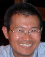
 Bin Jiangis professor in geographic information science, geographic information systems or geoinformatics at the University of G?vle, Sweden. He undertakes research on spatial analysis and modelling, and visualization. Geospatial analysis is much dominated by two stubborn mindsets: one is geometric thinking in terms of size, shape, and position, and another is a Gaussian way of thinking when comes to spatial statistics for characterizing spatial properties such as spatial dependence and spatial heterogeneity. In contrast to these two mindsets, I believe that topology and scaling matter more in geospatial analysis for uncovering underlying structures and patterns. Topology refers to topological relationships of numerous geographic units, while scaling is often characterized by a power law distribution or a heavy tailed distribution in general. In this talk, I will discuss something of paradigm shift from geometric to topological and from the Gaussian mindset to something which is “more normal than normal” – the so called scaling property. I will draw upon some of our recent studies on illustrating underlying structure of urban street networks, or scaling of geographic space in general, to show the power of the new mindsets in geospatial analysis.
 Professor Nicholas Coops is a Canada Research Chair (CRC) in Remote Sensing based at the University of British Columbia (UBC), Vancouver Canada. He undertakes research on the application of remote sensing for forest and conservation management. In his talk he will discuss some underlying relationships between vegetation functioning and leaf reflectance which is allowing remote sensing to provide continuous data into carbon models of vegetation production. He will discuss this work in the context of regional and national level forest management, where these models can provide critical information on vegetation responses to changes in climate. Dr Coops will also provide a general overview of other research in his lab, such as LIDAR applications in forestry and urban environments, as well as briefly summarize his editorial experiences as Editor-in-Chief of the Canadian Journal of Remote Sensing (CJRS), and provide some general tips for successful publication。
Time:9:00 am September 19, 2011
10:00 am September 20, 2011
Venue:Room 2321, IGSNRR
Source: State Key Laboratory of Resources and Environmental Information System
Download attachment: