Three Famous Corridors
The Hexi Corridor, located between Qilian Mountain and Beishan Mountain, is topographically a basin in the north of Gansu Province in western China. It got the name for its low topography, narrow shape and its location in the west of the Yellow River. The Hexi Corridor stretches 1,200 kilometers, including areas of mountains, Gobi and oases. The ancient Silk Road began at the magnificent capital city of Chang′an (today′s Xi′an); the route took traders westwards into Gansu Province through Lanzhou, Tianshui, Zhangye, Jiuquan along the Hexi Corridor, whose west end is Dunhuang. Out of the Hexi Corridor, the ancient Silk Road stretched into the Tarim basin, via which it finally reached Europe.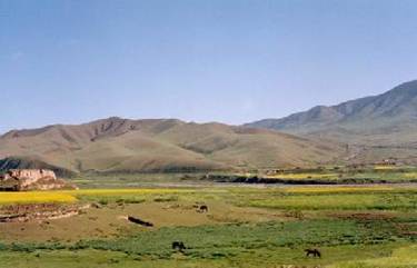
The Liaoxi Corridor, lying on the southwest of Liaoning Province in Northeast China, is a long and narrow plain along the Bohai Sea. Its width varies from two kilometers to dozen kilometers. In ancient times, it was the main land routeway connecting northeast areas and the middle and lower reaches of the Yellow River.
 The Taiwan Straits, nicknamed the Sea Corridor, is an important watercourse connecting East China Sea and South China Sea. Most notably, the Penghu islands of the Straits are the strategic point of the sea route. Records have it that the famous navigator Zhenhe once relaxed on the Penghu islands on his expedition to the West Sea (present-day the South Sea, or the Southeast Asia).
Source:http://www.chinaculture.org
