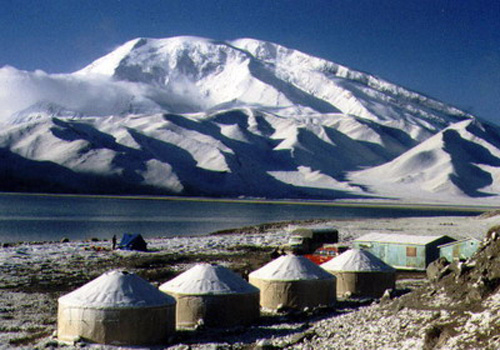
Mount Muztag
Mount Muztag Photo: Li Bingyuan
Time: 14th July, 1987
Site: Karakol, Taxkorgan, Xinjiang Height: 3680 m
Brief Introduction: Mount Muztag lies on the west of the Kunlun Mountains,75.1°E,38.5°N. It is the second highest peak of the Kunlun Mountains. Occupying an area of 258 square kilometers and with fault scarps and a relatively smooth top surface, this block mountain developed modern glaciers, the ends of which reach heights from 5020 to 3900 meters. The largest two, the Xili and Kematule Gllaciers, split the mountain body into half transversely. Slopes on west face of the mountain are even, whereas those on north and east faces are quite rugged. Mount Muztag holds a near-round shape, is covered by perennial snow, with a snow line of about 5200 meters high. Northwest of the Mount is a glacial lake, Karakol, walled up by ancient moraines at a height of 3652 meters, with Chinese-Pakistani Road passing by its western side.